Freetown, 7th September, 2026 – The United Nations General Assembly has overwhelmingly approved a resolution to adopt a new world map projection that more accurately reflects the true size of continents and countries, marking what African leaders hailed as a “historic step” toward fairer global representation.
The resolution, spearheaded by Togo and strongly backed by the African Union, won resounding support with 164 votes in favour, six abstentions, and just one against. The United States stood alone in opposition.
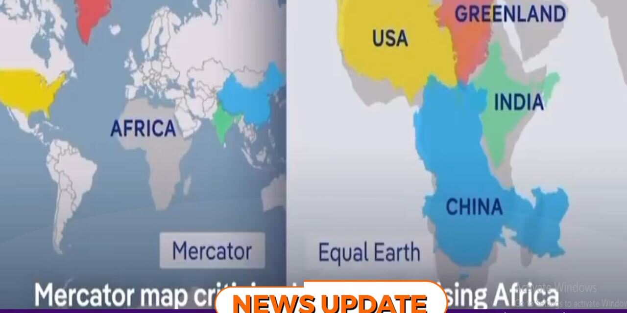
At the heart of the decision is the Equal Earth projection, developed in 2018 by cartographers seeking to correct distortions in the widely used Mercator projection. Unlike Mercator maps, which exaggerate the size of regions such as Europe and North America while shrinking Africa and South America, the Equal Earth projection presents countries in proportion to their actual landmass.
African delegates argued that the move was not merely technical but symbolic, challenging centuries of cartographic bias. “This vote is a historic step toward accurate and equitable representation of our world,” the African Union declared after the resolution passed.
The campaign, led by Togo, gained momentum across Africa and beyond, with supporters emphasizing that maps shape perceptions of power, geography, and identity. By adopting the Equal Earth projection, the UN aims to promote a more balanced understanding of global realities.
The decision underscores Africa’s growing influence in international diplomacy and its push for reforms that reflect fairness and inclusivity.